Cartograms
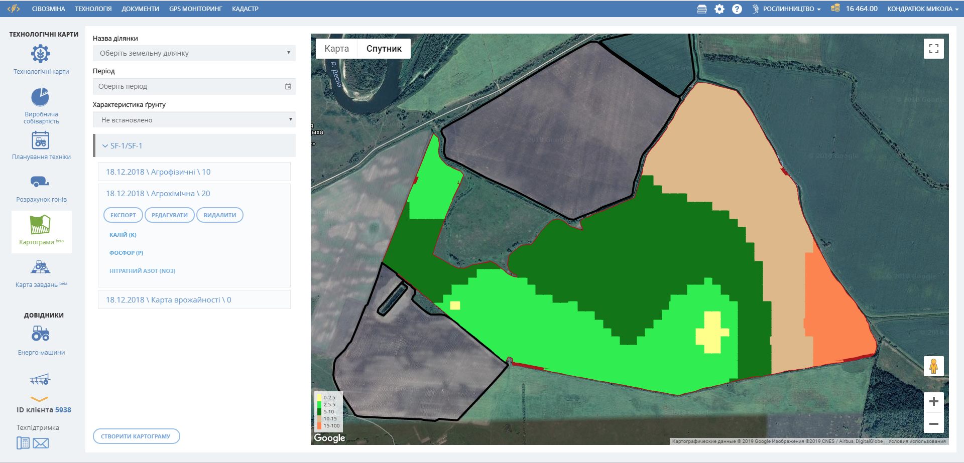
Soil properties
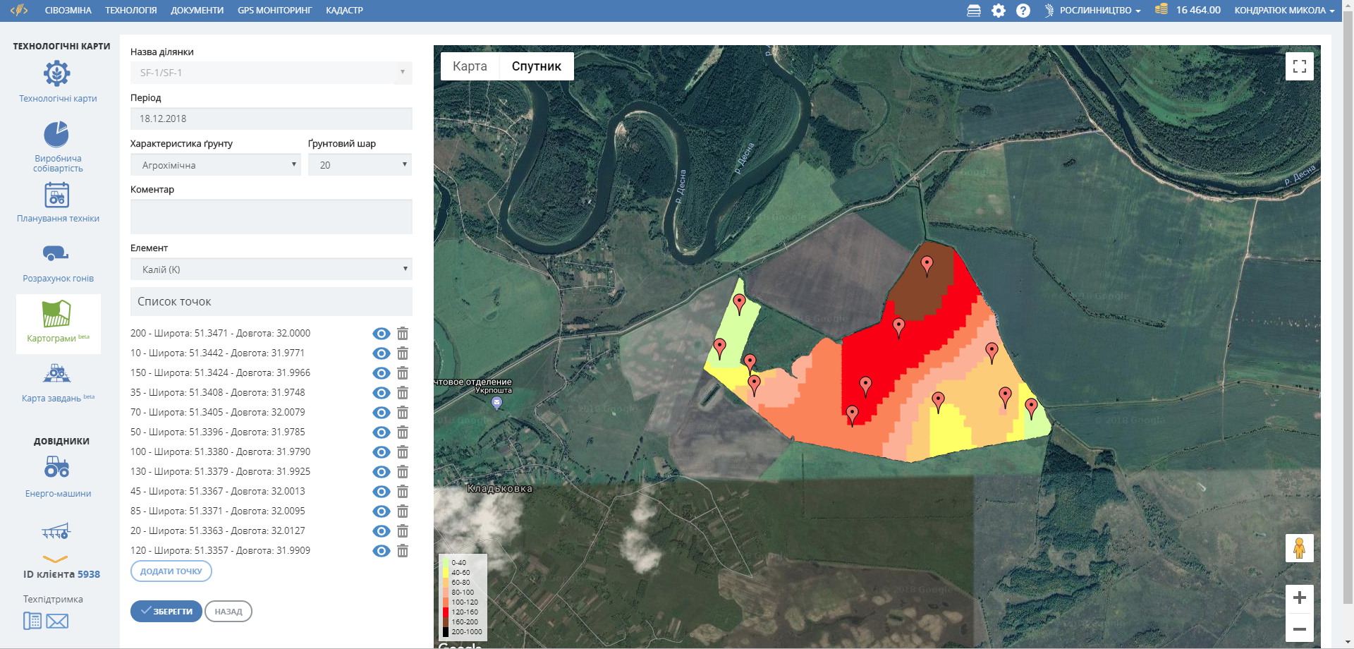
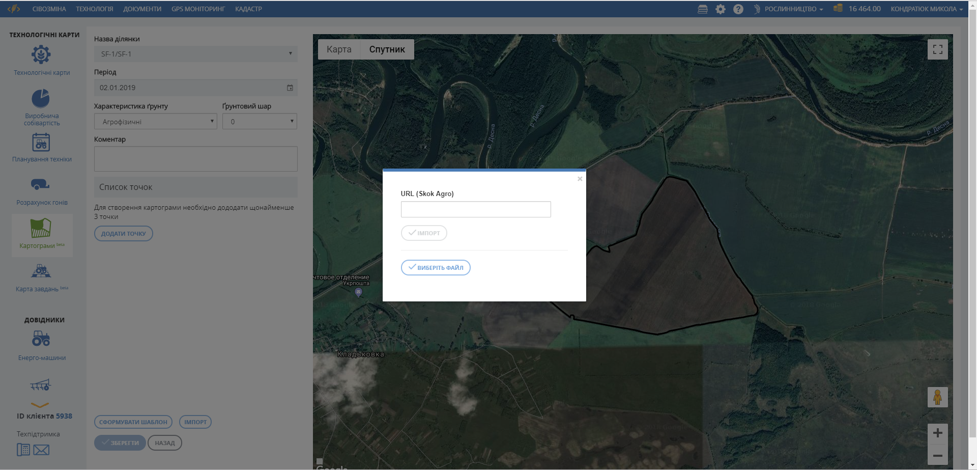
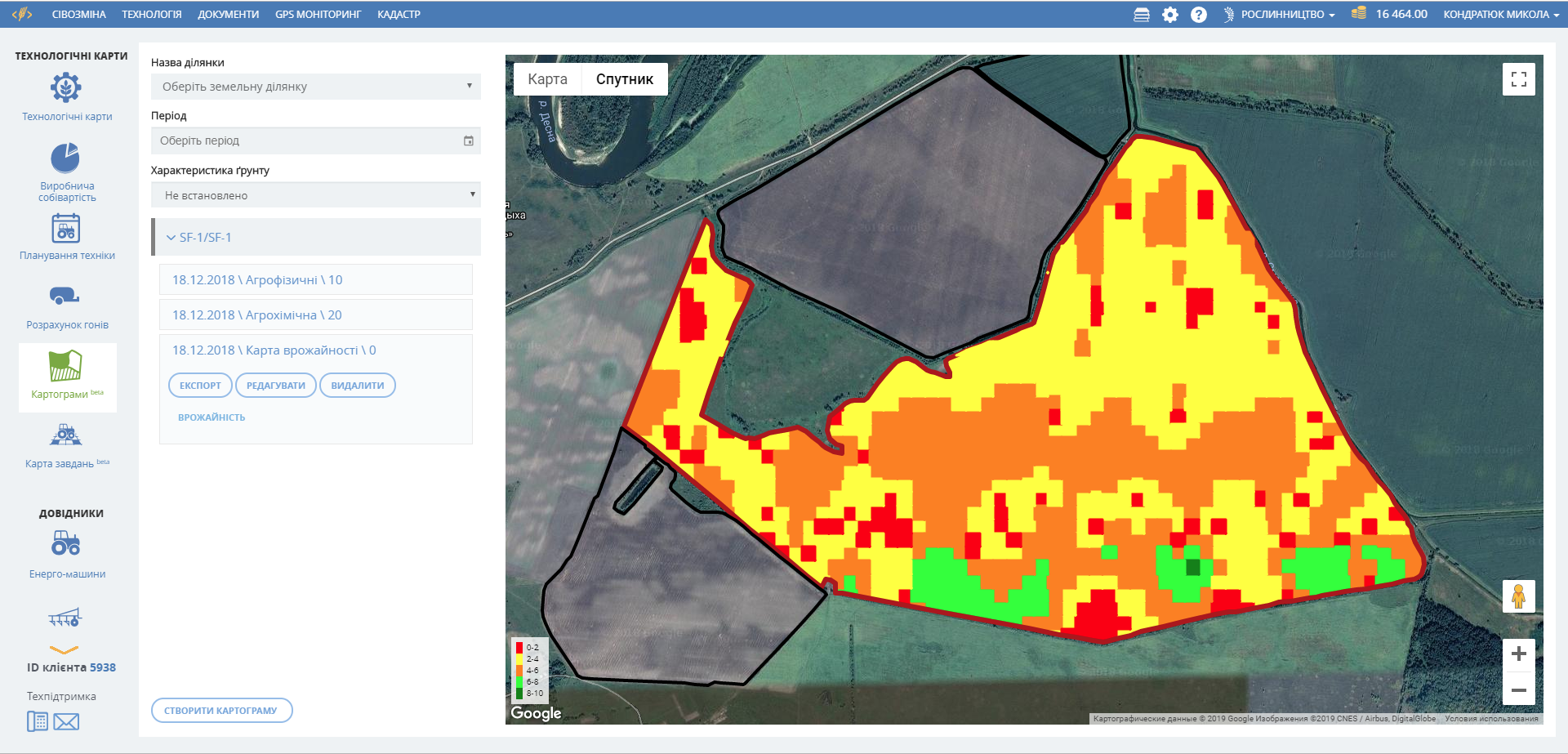
The main asset of an agricultural enterprise is a soil. Growing a good harvest requires careful study of the composition of the soil on the basis of which the crops are grown. Soil assessment begins with the determination of the agrophysical and agrochemical properties of the soil. It is very expensive and not always effective to carry out chemical analysis of the soil of the entire land bank using 3-5 ha scale; it is more expedient to analyze the NDVI index over several years, to identify problem areas of the field and then to examine them carefully. The obtained results of the chemical analysis or measurement of soil compaction (using a penetrometer) can be downloaded to the Cartograms module of the
Soft.Farm
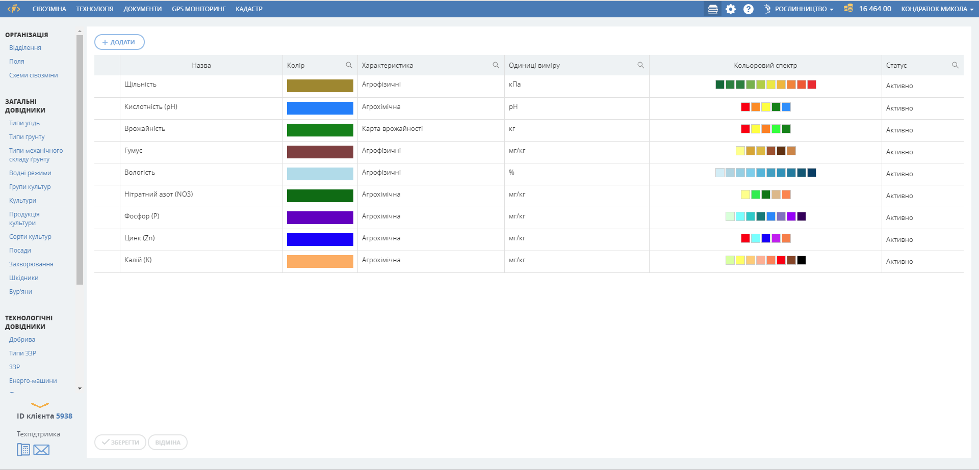
system, which will build a map of the indicators distribution across the field, from one soil sample to another. Thus, you will be able to determine the properties of the soil at any point of the field, which is much more profitable than a net survey. It is no longer a problem to store and search of information upon the nutrient content (N P K and others), mechanical composition or soil moisture as the access to information will be fast, convenient and safe.
Seeding and Yield Maps
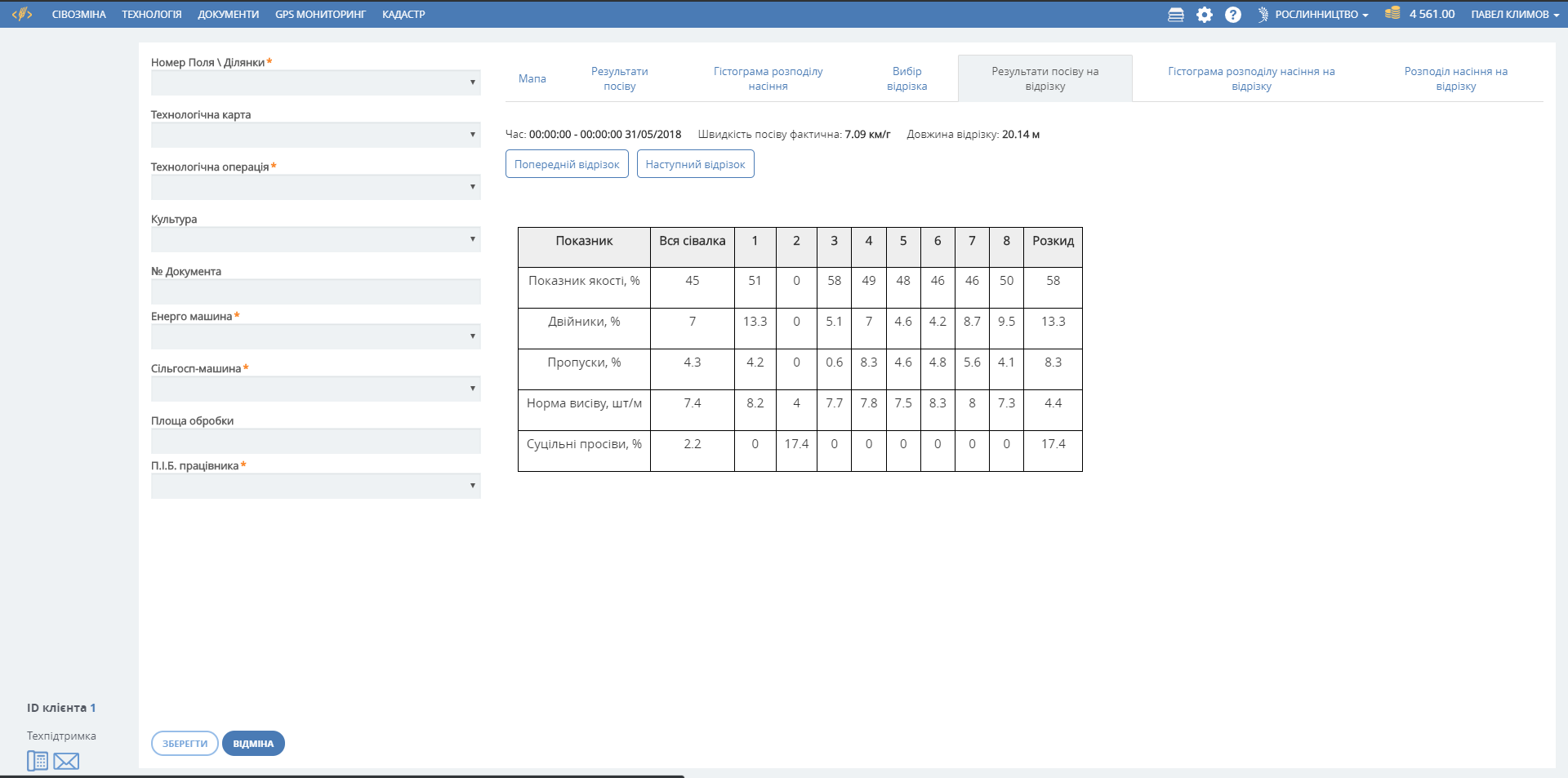
Comprehensive soil analysis allows developing an optimal plant nutrition system, selecting the right hybrids for sowing, but it is impossible to analyze the impact of the implemented agrotechnological measures on the yield of each land plot with this technology. Taking into account the level of modern systems of precision farming, nothing is impossible; the cartography of agricultural works for each meter of the field in the form of seeding maps and yield maps has already become a reality. Seeding maps allow you to control the rate and receive information on the number of doubles or gaps. Yield maps store information about the weight and moisture of the harvested grain. This important information is downloaded into the Cartograms module and is provided in graphical form for further analysis. The system allows you to overlay layers of soil properties on the layers of seeding maps or yield maps and compare them. Use modern tools to determine the factors that affect yielding capacity.


Learn to create cartograms and yield maps by yourself!
We have developed and are constantly improving video tutorials for the practical use of the system and its functions - cartograms, yield maps and seeding maps.
Subscribe to our channel!