Agronomist’s tablet with the «Agroscouting» mobile app
20.04 2020
Information technologies has already firmly entered in the everyday life of farmers and is an integral part of any modern agricultural enterprise. One of the most popular tools is agricultural scouting, which is a procedure for collecting information directly in the field in accordance with the specified parameters and serves to monitor the status of crops. Inspections of the field allow not only to determine the stages of plant development on the BBCH scale, soil condition, the presence of diseases, foci of spread of weeds or pests, but also to control the quality of performed work on the field and to form recommendations for its further processing.

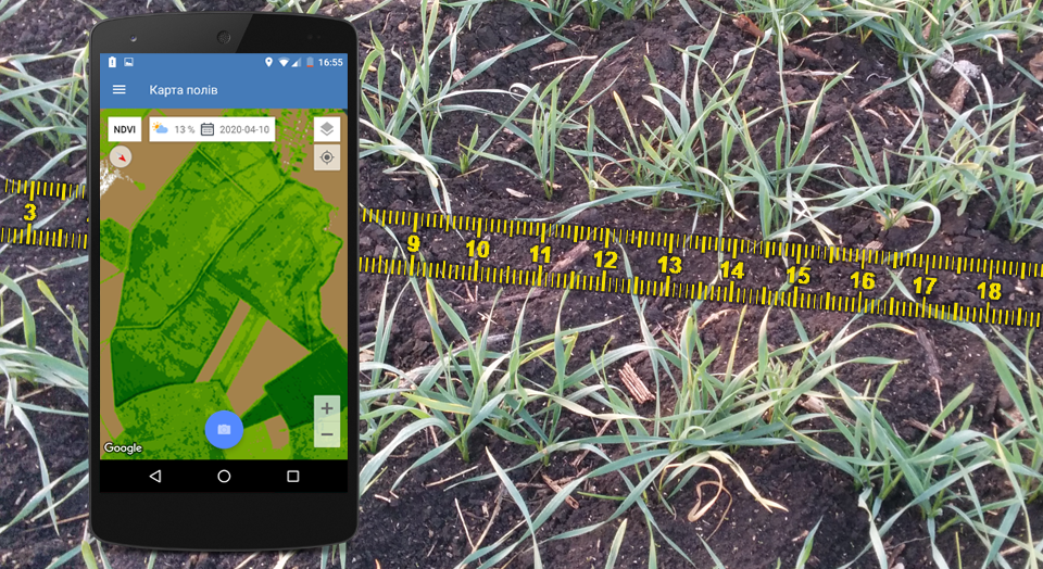
Modern agronomists are free to use PCs, tablets and other devices that are equipped with convenient tools for solving production problems and provide access to a cloud database. An agroscout or a mobile agronomist collects data in the field using a tablet with the «Agroscouting» mobile application, which allows you to quickly find fields using the built-in satellite navigation and automatically records the dates and times of their visits, which makes it possible to control the quality of the survey. It draws up a survey Act with geo-referencing to the sites being inspected, adds photos and text notes using an exhaustively comprehensive database of diseases identified by pests or weeds. In addition to this, the Soft.Farm team improved the mobile application and now problem areas can be found using satellite images, which allow you to see the current NDVI index on the field and make a more thorough phytosanitary assessment.
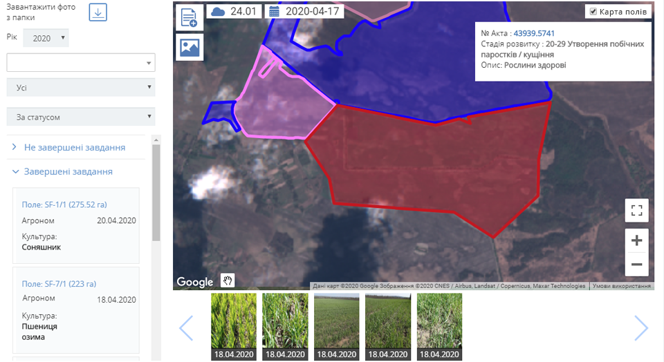
To create inspection reports it is possible not only using the mobile application. In the latest update of the «Agroscouting» module in the Soft.Farm web version, in addition to adding photos and videos taken during self-examination of the field, it became possible to batch upload images from drones. If UAV is used in the work of an agricultural enterprise, the data obtained with its help will be invaluable. Each photo taken by the drone has information with the coordinates of the shooting location. After loading the images into the program, the system will automatically determine the location of the image and attach it to the field being studied, as well as show a marker on the map and create an inspection Act.
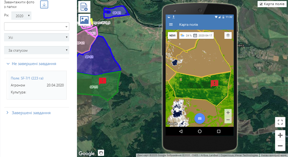
If problem areas are detected using satellite images, images from drones, or in another way, the chief agronomist has the opportunity to give a new task to examine the field from a computer to a mobile application. Agroscout will be able to create survey Acts and add new photos even offline, and after synchronizing the survey data, the mobile device will automatically upload photos and GPS coordinates to the Soft.Farm web service when connected to the Internet, where they will immediately be available to other employees and will be stored in field history.
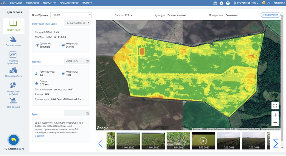
At any time, the manager can see how many reports have been created for each field, in which areas they are not present, and when the last report on the date was made. Thus, from the office he can immediately see what is happening in the fields and how agronomists work. It is possible to request the collected data, sort them by dates, fields, cultures, types and degrees of threat, frequency of visits, analyze readings together with maps, field snapshots and other data to form conclusions about the situation in a particular area. Thanks to the well-established interaction between agricultural scouting and production, access to timely and reliable information is ensured, risks are predicted, positive and negative dynamics of plant development are monitored, corrections are promptly made and problems arising are eliminated. Adjusted differential rates of seeding, fertilizing and plant protection will save money and optimize costs per hectare, and the reclamation of identified badlands will help conserve resources and form new types of crop rotation.
Agroscouting module promptly informs about technology violations and helps to eliminate inconsistencies in advance, it makes it possible to strengthen control over the state of the fields by accumulating an array of data about each site. Given the current pace of development of the agricultural sector, only innovative approaches and the availability of information can achieve competitive results.
Back to news list