Cadastral map as a land bank management tool
16.07 2020
The efficiency of the land bank management system, which is a key production asset, largely depends on the work of the land department, namely on the quality of the lease agreements and their further accounting in software systems.
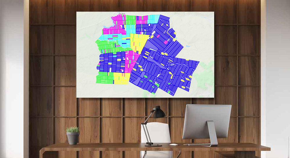
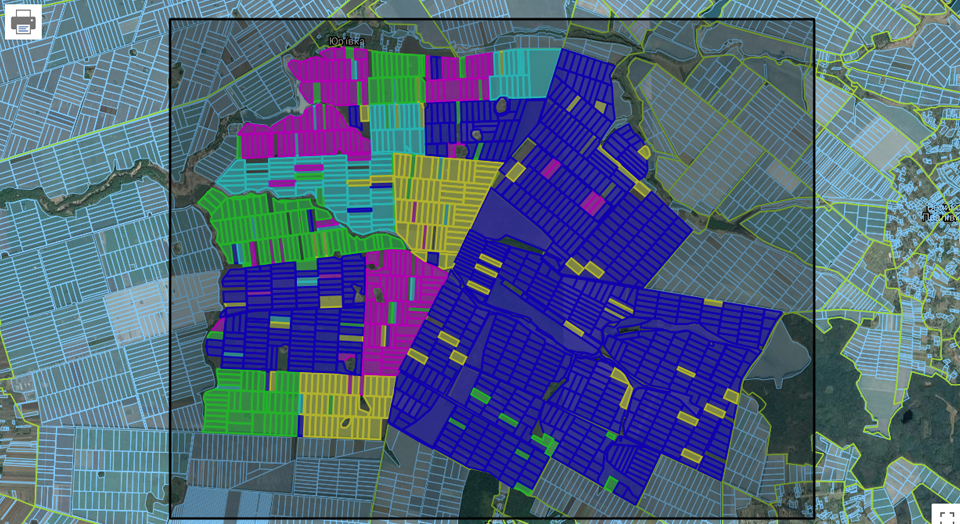
Today, the Soft.Farm web service has all the necessary tools for cadastral accounting, which includes visualization of farm fields and all cadastral plots located on the territory of the cultivated areas and beyond, a system of operational reporting in the context of fields, branches, village councils, tenants, as well as structuring of all lease agreements, indicated on the map with certain colors and markers in accordance with their type, status, validity period, distribution, etc. The system allows you to create schemes for the exchange of land plots and see on the map all lands transferred and received by exchange, which enables the manager to control the transfer processes and the balance of the received and transferred areas. Using the layer of the Public Cadastral Map of Ukraine, you can see the location and current distribution of cadastral plots, and thanks to the Soft.Farm function for obtaining information about ownership from the Register, it is possible to monitor and compare the data on landlords available to the agricultural enterprise and in the State Geocadastre.

The land bank is in constant flux and inevitably changes over time. It is not enough to make a one-time analysis of it and expect a static state, since not only the boundaries of the cultivated areas are subject to changes, but also the land plots themselves as an object of ownership and lease relations. New owners enter into inheritance, contracts with competing firms are renegotiated, agreements on neighbor's plots are drawn up, the rights to unclaimed shares are declared — and this is not a complete list of changes that need to be followed. To solve this problem, the Soft.Farm web service expanded the functionality of the cadastral module and added the ability to control property rights to land plots. Now, in addition to the data stored in the archive and the complete history of all entered documents with different types, statuses, and contract periods, it is possible to mark cadastral plots for which it is necessary to re-request information on ownership rights from the Register. If a change of ownership has occurred for some share, the system will designate this area with an exclamation mark and set the appropriate planned action, which will make it possible to see it on the map and respond in time to the changes that have occurred.

The Soft.Farm team not only supports innovation, but also respects the already established habits. At many enterprises where our system was implemented, we observed field maps hanging on the wall, divided into cadastral plots and marked with different colors depending on the current needs of the farm. Some cards are colored according to tenants, others have unit numbers written on them, and still others are marked with symbols that require special attention. In our web service, we have implemented the ability to print a map of an agricultural enterprise in high resolution. Now, in addition to the electronic map of fields and plots, which is in the computer, you can have at hand the usual paper map, and in any format.
Soft.Farm always listens to the needs of its clients and our main advantage is the automation of management processes for both the land bank in particular and the entire farm in general. Systematization of the information received and prompt response to changes makes it possible to reduce the risks of doing business and be one step ahead of competitors.
Back to news list