Cartograms are the beginning of precision farming
21.11 2019
It's no secret that the main asset of each agricultural enterprise is land: lease agreements are concluded, cadastral area is calculated, property rights documentation is kept ... But, in addition to legal data, it is also necessary to know the properties of the soils that make up the land bank and on which agricultural crops are grown culture.
To date, many laboratories offer soil agrodiagnostics services. They take samples and conduct a comprehensive agrochemical analysis of the soil, but the main problem is that each laboratory gives the received data in an individual format. It can be Excel, PDF, or paper in general, and as a result, it is very difficult for an agronomist to systematize, and even more so visualize information from disparate programs and conduct its qualitative analytics.
The Soft.Farm web service offers a solution to this problem. Now, a long introduction of the analysis results is not required and there is no need to store mountains of excess paper. It is enough to form and load the template in Excel format and the information is immediately visualized in the program. In addition to easily downloading documents from laboratories, Soft.Farm automatically imports data from the Skok Agro and DataField penetrometers onto the server.

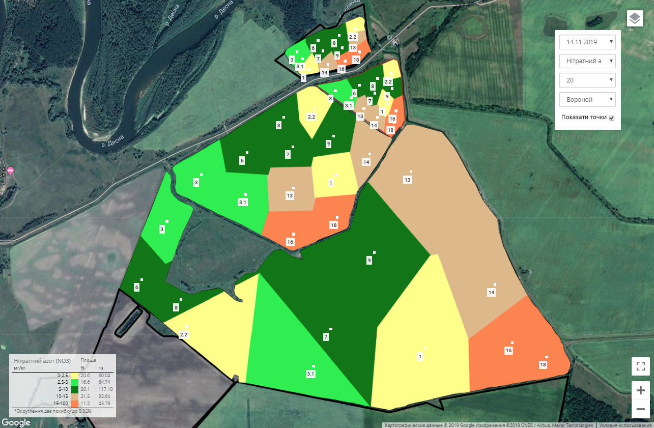
The system allows you to make agrophysical and agrochemical properties for any soil layer and for any element. For each element, it is possible to create your own color chart scale, highlighting separately the mechanical composition or moisture of the soil, as well as the content of nutrients (N, P, K, Ca, Mg, Fe, Zn, etc.) and other organic compounds of the main soil components. The results are converted into cartograms, for the creation of which the web service has combined several methods recognized by the international community. These are the methods of kriging, Voronoi and Bezier, any of which can be used for calculation.
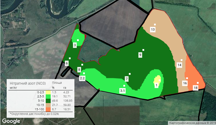
The main feature when creating cartograms in Soft.Farm is the automatic calculation of the area. But these are not just numbers: the number of areas with different chemical and physical properties is calculated. Thus, there is a breakdown by the content of elements and it is possible to distinguish zones with a high, medium or low content of a certain substance by a separate field or by the whole farm as a whole, which makes it possible for an agricultural enterprise to correctly build a system for providing soil with nutrients, calculate the required amount of fertilizers and optimize financial costs.

Soft.Farm provides an integrated approach to agribusiness and allows you to increase the efficiency of agricultural activities due to the qualitative analysis of cartogram data, field work, NDVI images and a land bank in one system.
Back to news list