Field eData portal, visualization Precision Planting .2020, shape
14.04 2021
The concept of precision farming is based on the idea of the existence of heterogeneities within the same field, which are identified and evaluated using the latest technologies, such as global positioning systems, special sensors, aerial and satellite imagery, as well as specialized programs for farm management based on geographic information systems. The collected data is used to assess the optimum seeding density, calculate the application rates of fertilizers and plant protection products, more accurately forecast yield and financial planning.
A personal approach to each field is a laborious process, which includes not only analysis of soils and yield maps, but also equipment with GPS monitoring systems, seeding control and autopilot systems for self-propelled vehicles, installation and management of a set of modern devices on trailed units, and much more. Each agricultural enterprise owns a different amount of equipment. Someone equips their farm with the best equipment on the market, and not necessarily of the same brand, while someone unlocks the potential of an existing fleet of machines through modernization and re-equipment. In both cases, there is a data compatibility issue.

To solve it, the Soft.Farm team has created a data processing portal that allows you to collect information from various machines together. This digital platform provides the ability to broadcast data from the world's largest agricultural equipment manufacturers such as Precision Planting, John Deere, Case IH and others. Thanks to it, from a large number of adjustable parameters, you can control the information that is most important for a particular farm and always know what is happening in the field with each pass of the equipment.
To date, manufacturers and developers of software and equipment have come to a single standard for data exchange in the ISO XML format. This format is flexible enough for use in various industries, including agriculture. Its specification is suitable for the creation and processing of documents by both programs and humans. It is aimed at compatibility between software products and equipment of different companies, which allows you to comfortably use equipment from different manufacturers in the same farm.
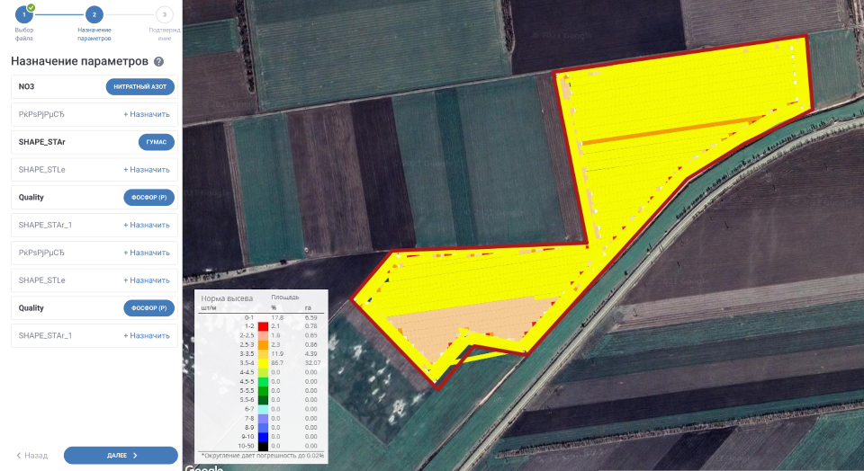
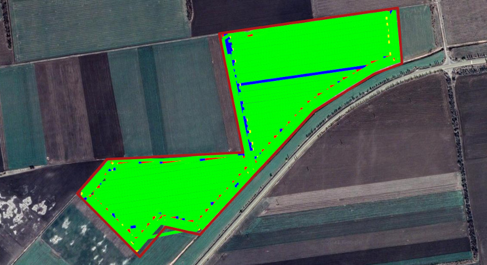
Also, many manufacturers of agricultural machinery support Shape-files (shp), which are used to exchange data between information systems. This vector format allows you to store various types of geometric objects such as points, lines, polygons, polylines, etc., and its structure is compatible with a wide range of software.
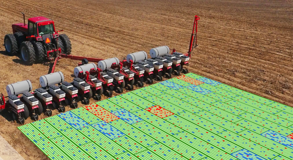
We consider the ability to work with .2020 data files from such a well-known manufacturer as Precision Planting to be especially successful. These files are specific to the 20|20 series on-board terminals, which provide control of various high-tech systems designed to control planting density, downforce and liquid fertilizer rates, multi-hybrid seeding and high-speed seeding, control of the singulation process, soil conditions, seeding rates, seeder pressure on the soil and much more. We have implemented the ability to upload this data to our portal by transferring files from flash drives and visualize the available information in the form of cartograms.

Not only singulation, seeding rate, differential application rate or yield can be mapped, but also Precision Planting specific data can be mapped to assess the performance of each section of the planter and the overall unit in any process step. This is of particular value during the sowing campaign. As a result, a complete report is generated on the amount of time and seed spent on work, the seeding rate, the presence of twins and gaps are monitored, and the sown area is calculated. The generated cartograms are available for subsequent analysis and comparison with yield maps, NDVI satellite images, results of soil chemical analysis, etc.
Digitalization of agriculture with Soft.Farm is easy. Individual approach to each field using digital tools allows you to save seed, increase seeding efficiency and overall crop yield.
Back to news list