What a satellite can see on the field, the efficiency of using the NDVI index
17.07 2019
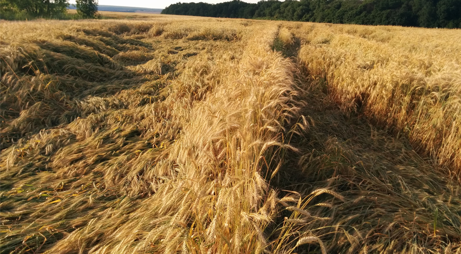
Recently, we drove to one of our clients and, passing by a field of winter wheat, saw the underlying crops. Along the way, we began to argue about what could have caused lying crops and what IT-technologies would help to see problems in time and assess winter crops. When we arrived at the agricultural enterprise, we asked the agronomist: “How are you going to assess the yield on this field?”. The answer was simple: “In fact!”. On the way home we decided to explore the field, measured the area of the parcel and took a photo with GPS-coordinates attached. The office made the field boundaries and ordered NDVI images for the necessary period. Frankly speaking, the results were disappointing:
- the average index did not change significantly;
- a detailed picture also did not identify the problem areas;
- tried other vegetation indices EVI, SAVI - even worse;
- only on the satellite image in natural colors saw small deviations.
We could not believe that the newest technologies in agro mean nothing. We continued the search and remembered the weather data that the satellite forms, but there was no anomalous precipitation and high wind speed. Only in the archives of public weather stations they found that three weeks ago there was rain and wind gusts of 8–10 m/s. The reason was found. It turns out that innovative technologies in agriculture have value.
According to satellite images, it was possible to determine the area of damaged areas with an error of up to 10%, but this is very inaccurate. For the qualitative determination of the area, it was necessary to make an orthophoto plan drone ... And then we remembered the words of the agronomist "in fact", which no longer seemed so useless.
To summarize: satellite monitoring, in particular, the vegetation index, can be useful if it is possible to receive archive data for 2-3 years. This information will help identify problem areas on the field, optimize the number of soil sampling points for agrochemical research, create soil cartograms and build job cards for differential fertilization . The accumulation and analysis of data is the path to building a precision farming system that will help reduce material costs and create a modern agricultural enterprise.
Back to news list